Canyons Trail

Explore the surface resources and geologic features of the Monument by hiking in the backcountry.
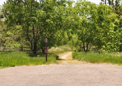
The trail begins at the covered patio outside the visitor center lobby and winds its way down into Lithograph Canyon.
Turning right at a fence, hikers enter Hell Canyon and stroll along a combination of unpaved roads and open meadows to a sign that leads to the historic entrance. From there, it is around one mile back to the visitor center.
Hiking Time: ~ 2-4 hours
Terrain: ~ Moderate to steep inclines. Not accessible for wheelchairs or strollers.

Trail Elevation:
Trail Difficulty: Easy, Moderate
Trail Distance: ~ 3.5 miles (5.6 km)

South Dakota Trails / State Parks

Palisades State Park

Palisades State Park

West Whitlock Recreation Area

West Whitlock Recreation Area

Custer State Park

Custer State Park

Legion Lake Trail

Legion Lake Trail

Platte Creek Recreation Area

Platte Creek Recreation Area

Fisher Grove State Park

Fisher Grove State Park

Spring Creek Recreation Area

Spring Creek Recreation Area

Lake Alvin Recreation Area

Lake Alvin Recreation Area

Pierson Ranch Recreation Area

Pierson Ranch Recreation Area

Newton Hills State Park

Newton Hills State Park

Pringle Trailhead

Pringle Trailhead

West Pollock Recreation Area

West Pollock Recreation Area

Pickerel Lake Recreation Area

Pickerel Lake Recreation Area

BHNF Trail #4: Cathedral Spires

BHNF Trail #4: Cathedral Spires

Dumont Trailhead

Dumont Trailhead

Lake Vermillion Recreation Area

Lake Vermillion Recreation Area

Sugarloaf Trailhead

Sugarloaf Trailhead

Saddle Pass

Saddle Pass